Friday, June 30, 2006

Desert runs (part 2.5)

NOTE: This is the description of the second run I did in (around) Las Vegas. I am giving this a separate post because the pictures take up quite a bit of real estate. This run was done on the second day after the Red Rocks run.

Lake Meade


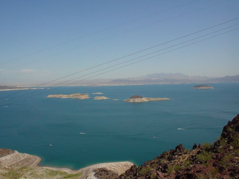
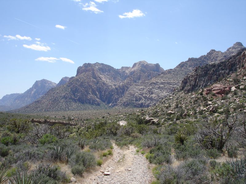
Being essentially a man-made lake createed by the Hoover Dam, the climate of the areas surrounding the lake are unlike almost any you will find around such a large body of water. Usually Lake Meade conjurs up images of boating, fishing and sunbathing, but the desert that surrounds it is much more fascinating in my mind. It is actually an area that includes three different desert ecosystems so there is a great variety of climate to be explored. For my run, I chose an area known as the Bowl of Fire. The area contains some amazing red sandstone walls that rival anything found in Red Rocks Canyon.
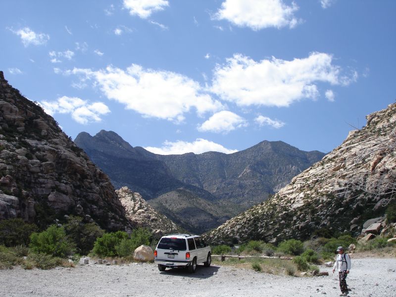
However, in order to get to the "bowl" (really a narrow canyon) you must first travel along a some very barren landscape. Travelling along what is essentially a sand road for four-wheel-drive vehicles I think the only signs of life I saw were desert brush and an occasional dragonfly.

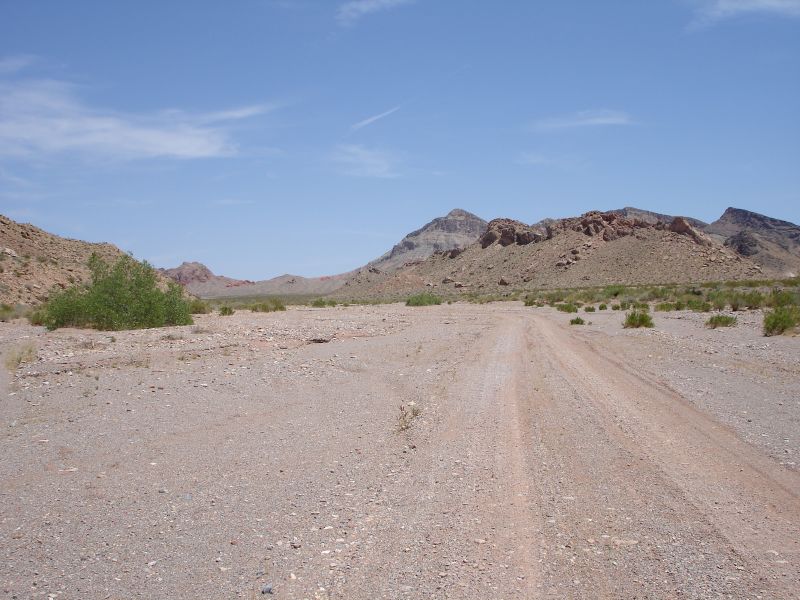
Except for those few bushes lining the road, there was a definite sense of "running on mars". Being in a climate not fit for life. It goes along this way for a few miles sort of slogging through loose sand until the red rocks of the canyon come into view.

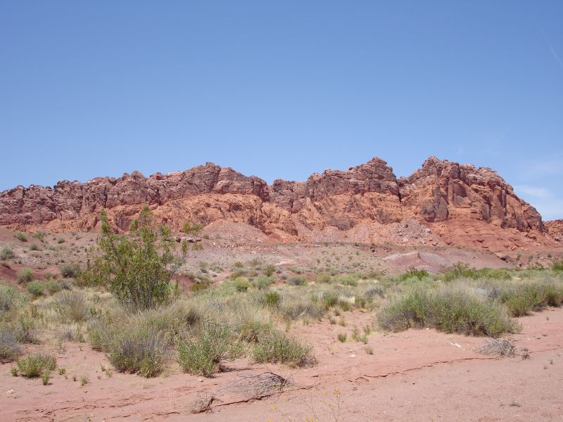
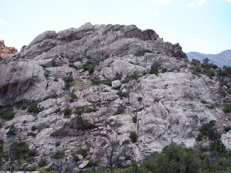
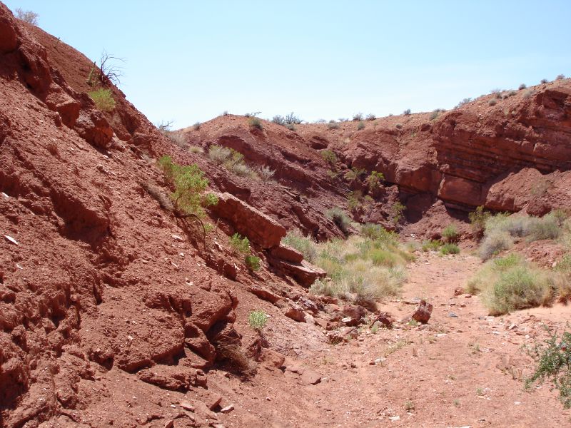
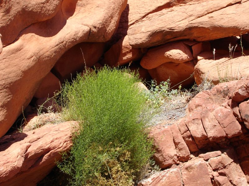
Then, eventually the road ends at some rocks setup to stop vehicles from going on further. It is here that the interesting bits begin. For the most part the canyon is not too narrow and there is enough variety of terrain that you can avoid the "sand treadmill" down the center. There are a few more varieties of plantlife and the rock formations along the canyon walls keep things much more interesting.

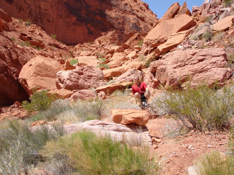
Well, the run part ends at a sort of rock wall that you have to scramble up. It feels like the end and I almost turned back here after taking a self-portrait. But its an easy scramble and worth a look on the other side, I thought.

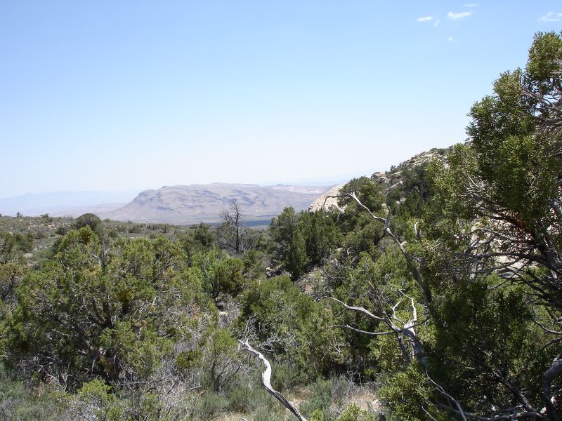
Once on top of the rocks, the view back is awesome...

...but, the view forward is even more interesting.

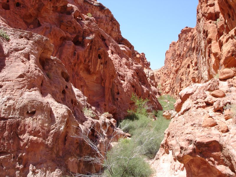
This is where the canyon narrows to near slot proportions. The rock textures also become much more varied and interesting pock-marked with a million holes. It is not really running terrain and I think it was better to just explore slowly anyway. There were so many interesting things to see and explore in that canyon that I would have stayed all afternoon had I made it the plan. You can view my full slideshow here. But the sun was heating up and my supplies were limited so back to the car it was. One last parting memory shows the amazing contrast of the area called the Bowl of Fire.

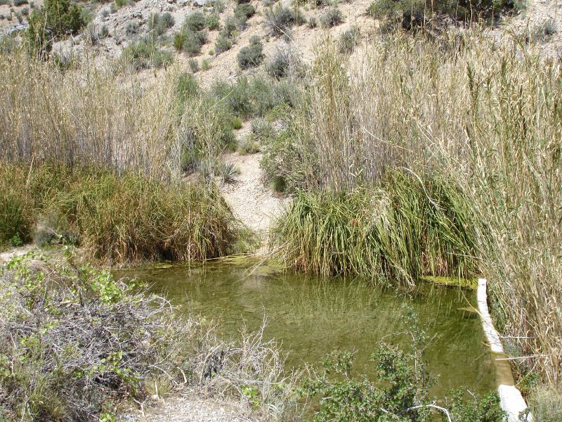
The run was close to 10 miles in total and is totally exposed throughout. On the way back I really began to feel the heat. While I had plenty of hydration, I realized that it wasn't much help in the desert when it heats up as drinking hot gatoraide just doesn't cut it. Much like the Grand Canyon, I can imagine someone getting stuck in this hot arid climate but still in view of the life giving water. I hope to return and enjoy more of what this (and other) deserts have to offer.

Sunday, June 25, 2006

Desert runs (part 2)

My other desert runs were done near Las Vegas. My wife, Zane, had a conference in Vegas so I decided to come along for the free hotel. While she was in sessions and meetins all day, I headed out to the desert. Despite the ever-growing suburban sprawl that extends in all directions from The Strip, there is still amazing and varied desert environs sourounding Vegas on all sides.

Red Rock Canyon


Famous for rock climbing and hiking "Red Rocks," as it is often called, is the most well known desert area outside of Vegas. I had only driven through the area in the past and definitely wanted to return to do a run. I chose the La Madre Springs/White Rock Loop as my introduction to the area. I did the loop in the reverse recommended direction in order to include the La Madre Springs out-and-back section near the end. Total mileage should have been around 8 miles, but confusion over where the trail went after the White Rock parking lot caused some extra backtrack-and-return mileage for a total closer to 9.
The variety of climate, terrain and plan life here were increadible. I took full advantage of the photo ops to record this wonderful diversity. The trail starts off in a typical Red Rocks scene of desert trees and shrubs along the base of the red sandstone walls.


As the trail name indicates, the red rocks give way to white rocks as you head around the the side of the mountain. This is also where the trail begins to climb a bit, though never becoming too terribly steep.


As you head further up and around the pine becomes thicker and views of the greater Vegas area come into site. The best view to be had is just before heading around the back side of White Rock Mountain.


Once on the back side, it begins to feel perhaps more like a forested mountain run than the deserts I had experienced in Arizona. Since the temperature was starting to rise this little bit of shade in the desert was very welcome.


Before completing the loop, I hooked up with the La Madre Springs trail to see what sort of springs one might find in this (now hot) desert climate. This trail, while short, added a bit of "real" climbing to the trip. It was strange to find this little pool of water sitting basically in the middle of nowhere. The spring is certainly not something that you could drink from, but dunking my head in was a nice cooling experience.


Finally, the run down back to the parking lot was great fun. Enough of a slope to let gravity do its thing and soft desert sand let me pick up a bit of speed. That combined with my now wet hair helped a add a bit further cooling. While my single hydration bottle did me fine for this run, I was reminded of how easy it is to dehydrate in the desert. My shirt was never really wet, but already had the tell tale signs of whiteness letting me know that plenty of sweat had already passed through and evaporated. I took one last look up the canyon before heading back down to the crowds and noise of Sin City.

Thursday, June 15, 2006

Desert runs (part 1)

Another set of runs I did during my training for Ohlone were some runs in the deserts of Arizona and Nevada. I thought that these would be good heat training. In the end, it really wasn't necessary as the temps were quite mild on race day (it even rained a bit). However, what I discovered was that running in the desert can be beautiful and challenging. I also learned how diverse the different desert climates can be.

Saguaro National Park

While traveling to Tucson to visit my oldest son, Jefferson, in college I did a couple of runs in what is often referred to as the "Cactus Forest". The reason for the nickname becomes quite obvious once you are there. Not only are there plenty of the namesake Saguaro Cactus, but there are also contains many other variety of cacti as well as a plethora of other desert flora. It is a very lush feeling environment for a desert.

Day 1
For my first run, I started from the scenic Forest Cactus Drive which requires an entrance fee (unless you already own a National Parks Pass which I highly recommend). I parked at the Loma Verde trail head and headed out the trail of the same name. Since I was planning a relatively short run and had was not carrying a map with me, I decided to stick along the trails on the outside edge of the complex, heading up to see the Three Tanks, but probably not as far as Bridal Wreath Falls since I had to meet for dinner in a few hours. The running was pure pleasure! Well-marked, soft (but not slippery), single-track, sand trails with enough twists and turns to be fun and enough rock steps and cactus to be mildly challenging and require you to keep you focus. There was very little elevation change along the route I'd planned, but enough small hills to go up and down and make me smile. The plan was to take the Loma Verde to Squeeze Pen to Camarillo to Three Tanks and then back. Apparently, I should have carried that map because, even with all nice little signs at every trail junction, I still managed to take a turn off of the Camarillo Trail which ended up dead ending. The problem is that I didn't immediately realize it. After spending the better part of 30 minutes running back and forth up and down imaginary trails that would simply end in cactus fields I backtracked to the main trail. It was here where I realized that I was actually wandering in nowhere land somewhere around a little watering hole named Little Wildhorse Tank. I found the Three Tanks junction and took it up to the first tank before heading back. In the end, getting lost just added more to the beautiful desert mystique. All in all, I estimate the run to be somewhere south of 9.5 miles.

Day 2
For the second day, I decided to do a little longer run. I had to meet Jefferson for a BBQ at his frat house in the afternoon, but I figured if I started reasonably early I could still get a couple of hours of running in. For this run I decided to do a run up to Douglas Spring Campground which is considered to be part of the Saguaro Wilderness Area. This trail climbs a couple of thousand feet over the approximately 6 miles to get to the campground and is usually done as part of a backpacking trip. The trail was again very beautiful, but much more challenging with all of the climbing especially given that much of it was up and over rock steps. I was reminded of the Muir Woods Trail Marathon I had just done the week before that included a significant amount of stairs on the course. Furthermore, since it ended up taking me close to 2 1/2 hours to run this trail, the heat started to climb just as I did. The single water bottle that I was carrying would definitely be drained before I finished (luckily I was smart enough to fill with Gatorade Endurance Formula as opposed to just plain water). Finishing this one was just as fun and even more rewarding. It really gave me a feel for true desert trail running which I had only experienced once before when running in the Grand Canyon. In that instance I ran from rim to river (or rather Phantom Ranch) and back. Unfortunately, I didn't realize that the drink powder I select was listed as "low sodium" and the second half of the "back" part became a hot, slow, painful slog up the Bright Angel Trail. This run in Tucson ended with much less pain, but I was defintiely starting to feel the desert heat at the end. I ended up going over my time limit and desperately needing to shower from the heat, dust and (oh yeah) one little trip I did when my foot caught on one of those rock steps, I was going to be a little bit late for that BBQ.

Monday, June 05, 2006

Key Training Runs

Reminiscing on my training runs leading up to Ohlone...

The key training runs were the (obvious) runs on the course itself as well as the Muir Woods Trail Marathon done about a month before the 50K.

Mission Peak

Living in the shadow of Mission Peak and only a few miles from the trailhead, I had done plenty of running in the Mission Peak Regional Preserve. However, I had never followed the section of the Ohlone Wilderness Trail that goes out to Sonol. I basically followed the first 9 or so miles of the course up and over the peak and down to Sonol and then back. Given the rainy winter we've had in the Bay Area there was plenty of mud on the trail and the less used sections such as Horse Haven were very difficult to find. This really gave me a feel for how I should handle the start of the race including my pacing. It also let me get in some serious hill climbing in during the return trip back up and over Mission Peak (ouch!). On the return I somehow totally missed Horse Haven and ended up romping around in nowhere land apparently following some sort of cow trail All in all, I estimate it to be around 19 miles including my off-trail diversion.


Sunol to Livermore

I have run and hiked in the Sunol Regional Wilderness a number of times including a run out to the backpacking area and one backpacking trip that included hiking part way to Rose Peak. However, I had never gone all the way to the peak let alone done the entire trail out to Del Valle Regional Park. This trail really was the crux of the Ohlone Wilderness 50K and would really let me know what to expect come race day. Not only did the 21+ miles represent the bulk of the course, but it was also the last part so I would have to imagine myself running it having already come up and over Mission Peak. For the most part, this run was great. It was freezing cold and windy up on Rose Peak, but pretty uneventful. I refilled my hydration pack at Maggies Half Acre and really enjoyed the next section of downhill. This was followed by some more moderate climbing which I stupidly thought was the "last uphill". It then headed down and along a beautiful piece of twisty singletrack.
As the trail wound its way into a ravine it dawned on me that this was not heading right down to Del Valle and I was going to have to climb back out of this thing. After crossing the creek, I looked up at the trail and my heart sunk. There was no way I was going to be able to do this come race day with another 9+ miles under my belt. I just sat down and put my head in my hands. I looked around and thought about the irony of feeling so incredibly shitty in what was probably the most gorgeous section of the entire trail. I told myself to just get up and start walking. It was a long slog, but I just kept going and was actually able to do my little shuffle-run for a bit of it. That made me feel better. When I did finally reach the "all-downhill from here" section, I was feeling good again and just started to cruise. Having short, stubby legs with big muscular thighs I am pretty much built for the downhills. Just when I thought all was good, my fluids ran out. With only about a mile to go it wouldn't be a problem, but it made sure that the suffering lasted until I reached the end.
All in all, it took me about 4.5 hours which was the longest I had ever run at the time. This meant that my theoretical fastest time for the race was probably around 6.5 hours, but I was thinking closer to 7 (which I went just over). This also meant that my wife, who picked me up in Del Valle, had a nice long wait in the car having shown up very much on the early side of my estimated finish time for this training run (sorry honey).

Muir Woods

On April 22, I ran the Muir Woods Marathon put on by Envirosports as a training run. While this is called a "marathon", Envirosports does not certify their courses and even brags that they are not regulation distance. I estimate this race to be closer to 25 miles or so. Distance aside, this is an absolutely beautiful course including a great variety of terrain and scenery. It starts at Stinson Beach (literally on the beach) and includes sections of the Dipsea and Steep Ravine trails (including many of the infamous stairs). There are lots of deep wooded terrain, stair steps, wooden bridges, a nice section of grassy trail overlooking the ocean and even a ladder climb. Did I mention the stairs? It was a great training run and I finished faster than I expected in 4:21. The stairs really gave me a workout. My legs were trained for hills, but I realized how different doing stairs are from simply running up or down hilly trails. You mean you actually have to lift your feet? I took one spill while pounding a fast downhill section, but managed a nice (dare I say graceful?) roll and landed back on my feet with only minor scratches and a few ego bruises. This run really gave me the confidence that I could finish a 50K especially afterI was able to knock off a 7 mile training run the following day. As much as I hated those stairs, I think they really helped as they forced me to walk a lot more than I might have othewise and I knew that walking was going to be key at Ohlone.